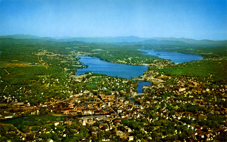
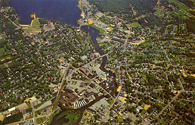
Here is the original aerial photo of Lakeport, Opeechee, and Paugus. Actually the photo shows quite a bit of downtown Laconia as well. Click here to SUPERSIZE this photo.
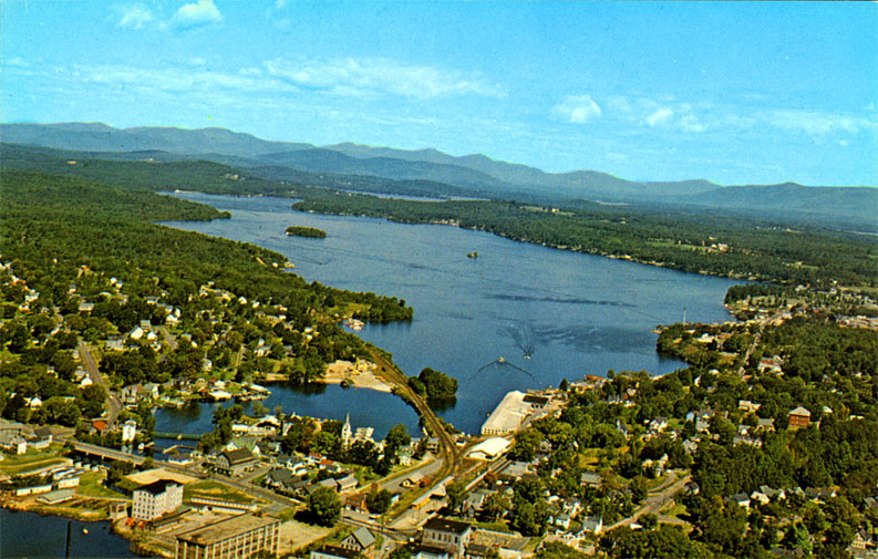
Here is an alternate view looking North of Paugus Bay, taken by Frank Forward. Click here to SUPERSIZE this photo of Paugus Bay.
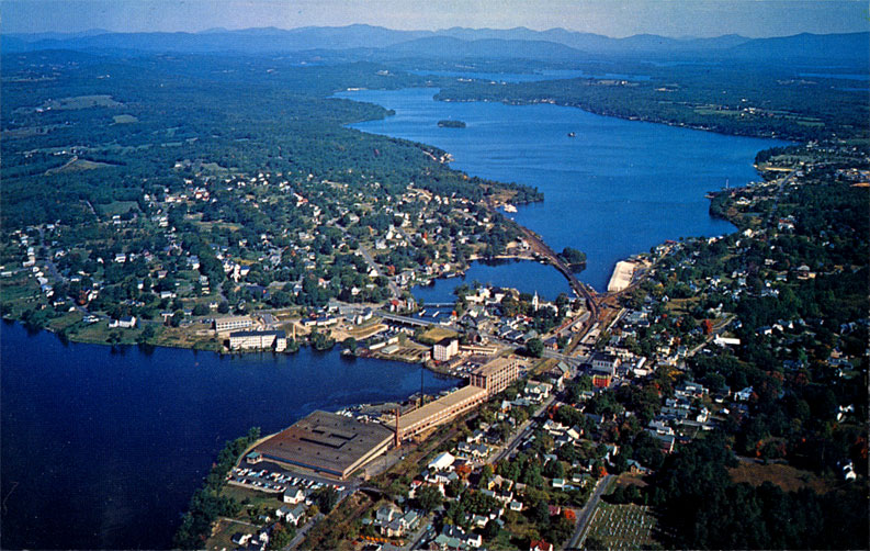
We also have this alternate view looking North, taken by Dick Smith. Click here to SUPERSIZE this photo of Lakeport, Opeechee, and Paugus, and for aerial photos of Lakeport in the 1940s.
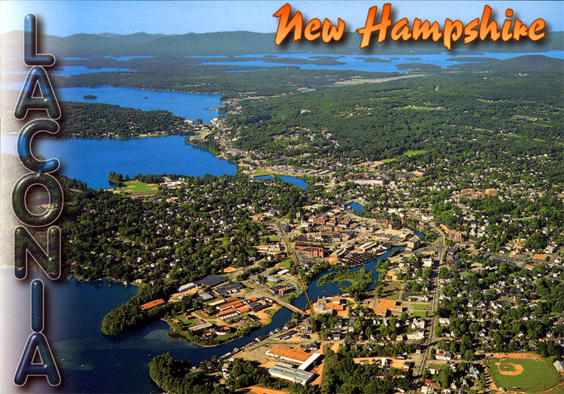
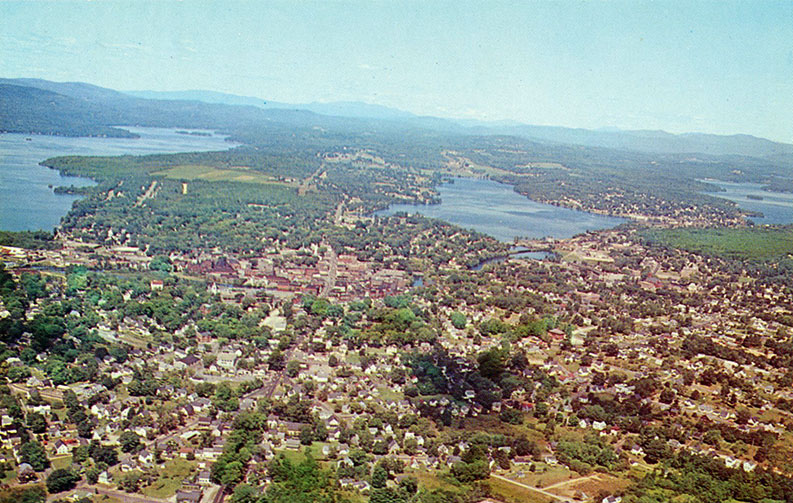
Here is another alternate view looking North, which shows not only Lakeport, Opechee, and Paugus, but also Laconia and Winnipesaukee!
This superb aerial photo was taken by Jim Abts, who also took the WeirsBeach.com home page aerial photo.
Click here to SUPERSIZE this photo of Laconia.
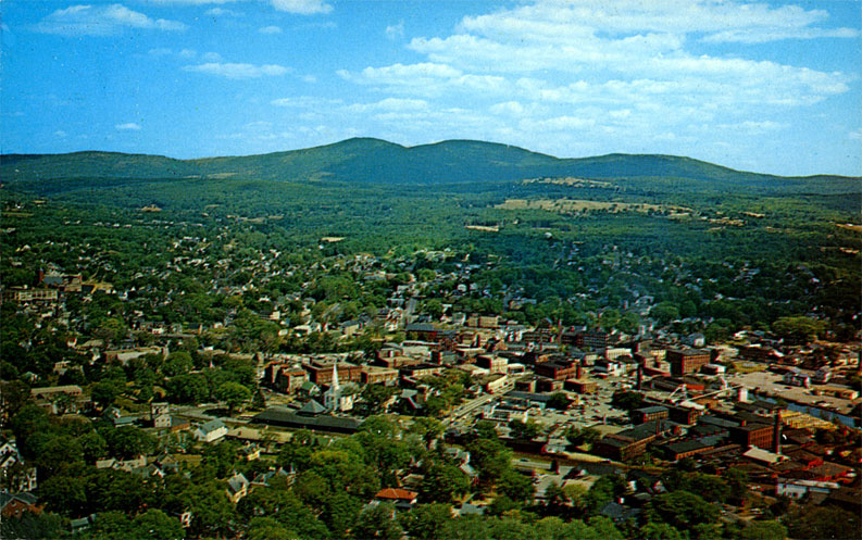
Here is another, older aerial view of downtown Laconia, this time looking in a Northeast direction towards the Belknap mountains.
This photo was taken before the 1966-1976 urban renewal, when many of the downtown's historic brick buildings were demolished.
Click here to enlarge the photo.
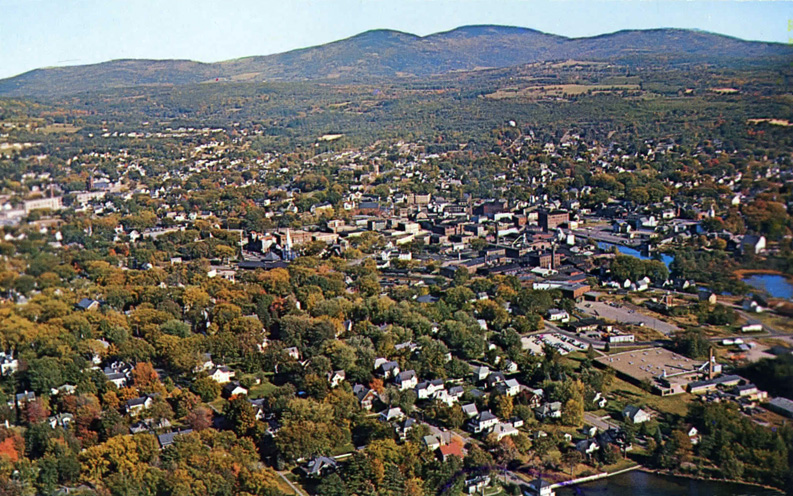
Below, a very similar view to the above photo, but taken from a little further away. Click here for enlargement.
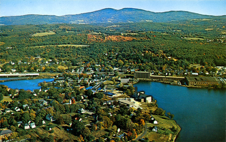
Here is another view of Lakeport by Frank Forward, looking in the same direction as the above photo - towards the Belknap mountains.
Click here to SUPERSIZE.
Yet another view of downtown Laconia, this one looking in still another direction, towards the Northwest, and taken circa 1976, or shortly after urban renewal had been completed.
Click here to double size the photo.
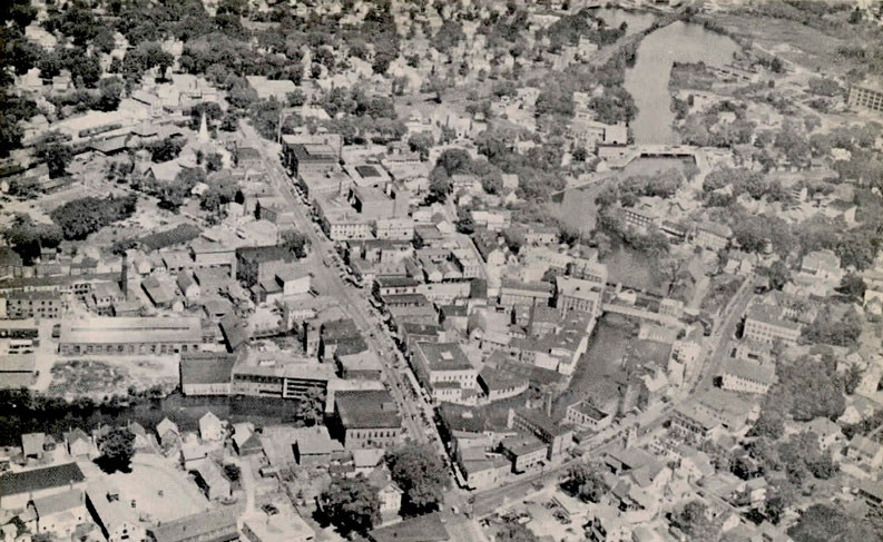
Here is a view of downtown Laconia, looking nearly straight down, taken in the early 1960's, prior to urban renewal.
Click here to double size the photo.
Here is a close-up aerial view of downtown Laconia in the 1940's.
Click here to double size the photo.
A color close-up view of downtown Laconia, 1950's, before urban renewal. Click here for enlargement.
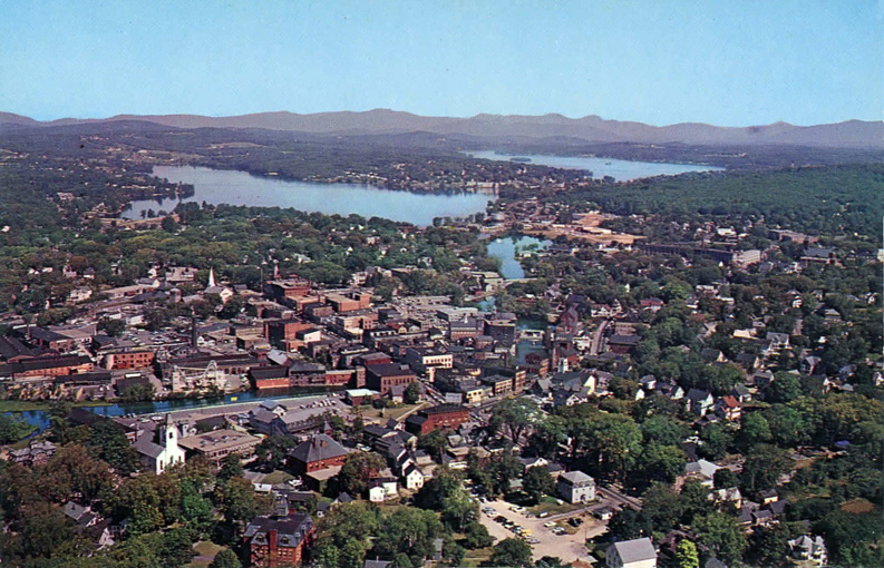
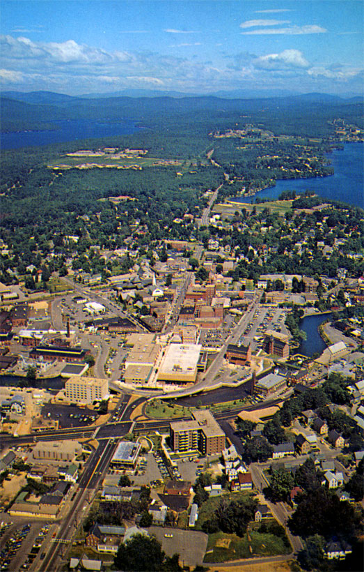
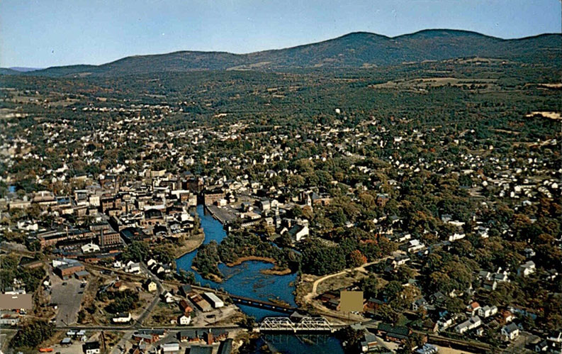
A wide view of Laconia, 1950's, includes all the lakes and mountains. Click here to supersize.
An aerial view of the Fair Street crossing in the 1950s shows the two bridges crossing the Winnipesaukee River just south of downtown. There was a truss bridge for automobiles and a railroad bridge as well.
An aerial view of the Fair Street crossing in the 1920s, taken by the early photographer E.D. Putnam, who also took the earliest aerial photos of Weirs Beach.Click here to SUPERSIZE.
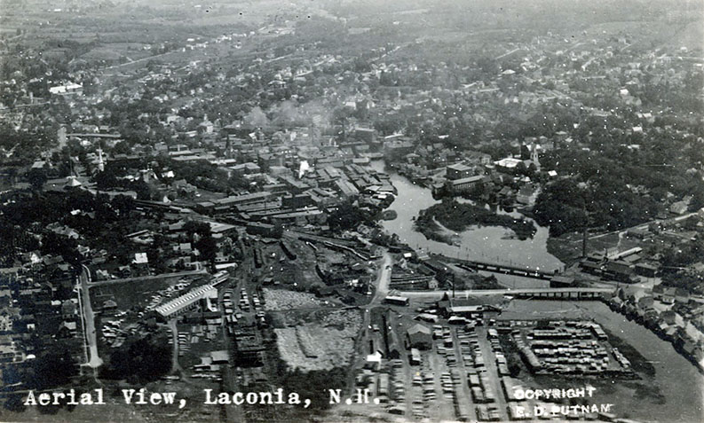
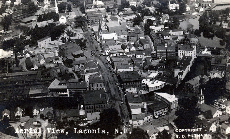
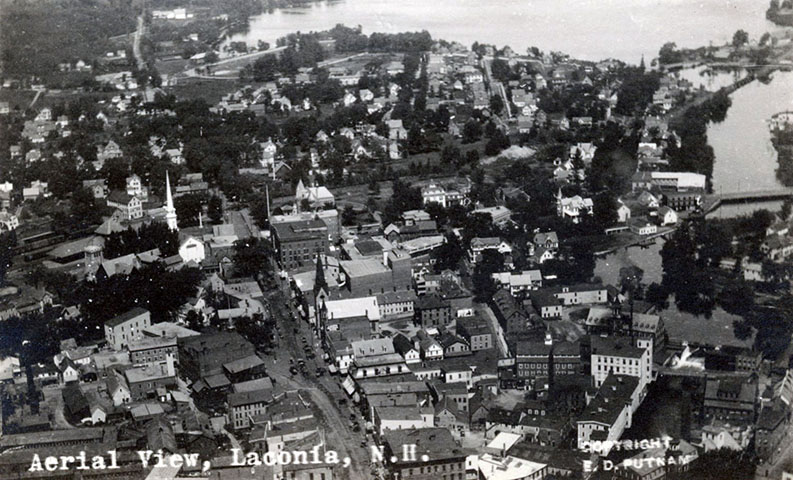
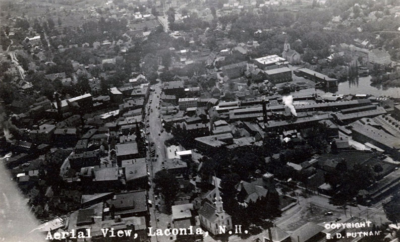
Here are three more of the very earliest aerial views of downtown Laconia taken by E.D. Putnam. Click here to SUPERSIZE.
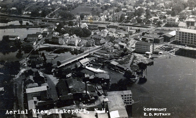
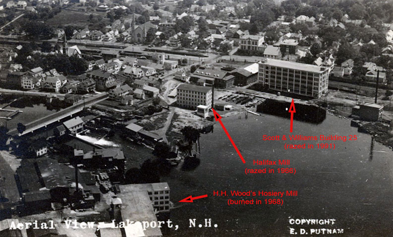
Here are two of the very earliest aerial views of Lakeport, by E.D. Putnam. As noted in the second photo, the three mill buildings seen in the aerials are no longer there. Click here to SUPERSIZE.
Not shown here are three of the very earliest aerial views of Normandin Square, by E.D. Putnam. Click to see these views.